By Maggie Alt
The W.R. Dillard Subdivision is located just north of Fredericksburg’s current southern border along the east side of Route 1, also known as Lafayette Boulevard. In 1935, Spotsylvania County’s Clerk of the Court sold the property as part of a chancery case involving the heirs of C. F. Graninger and advertised the land as a “highly desirable small farm” well-suited for subdivision into small plots.1 William Ryland Dillard, a lawyer and then treasurer of Spotsylvania County, purchased the land at auction on May 19, 1936.2 Dillard later sold the subdivided properties with his first wife, Genevieve, and, after remarrying, with his second wife, Elsie. He hired R. R. Curtis, a local surveyor, to map the initial subdivision on July 14, 1936, comprising 65 lots, with plans for future expansion.3 Dillard began selling these lots as early as July 20, 1936, including a racial covenant that would prevent the property from being owned or inhabited “by any individual not of the Caucasian race, for a period of 50 years from the date of this deed.”4
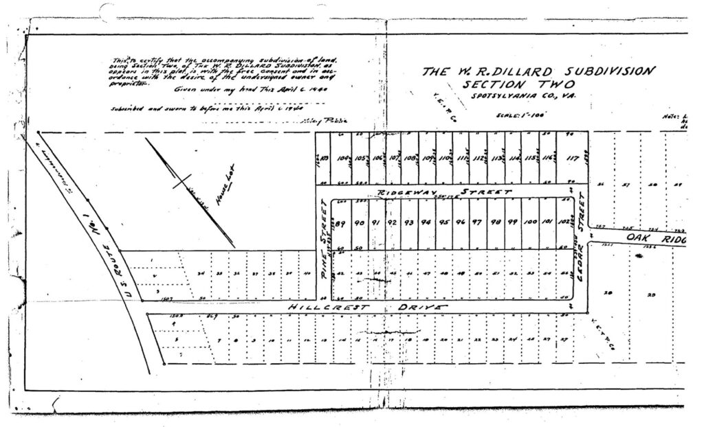
Figure I. Page 1 of the 1940 Survey of Dillard Subdivision expanding to include 52 more lots with the original plots depicted by dotted lines.
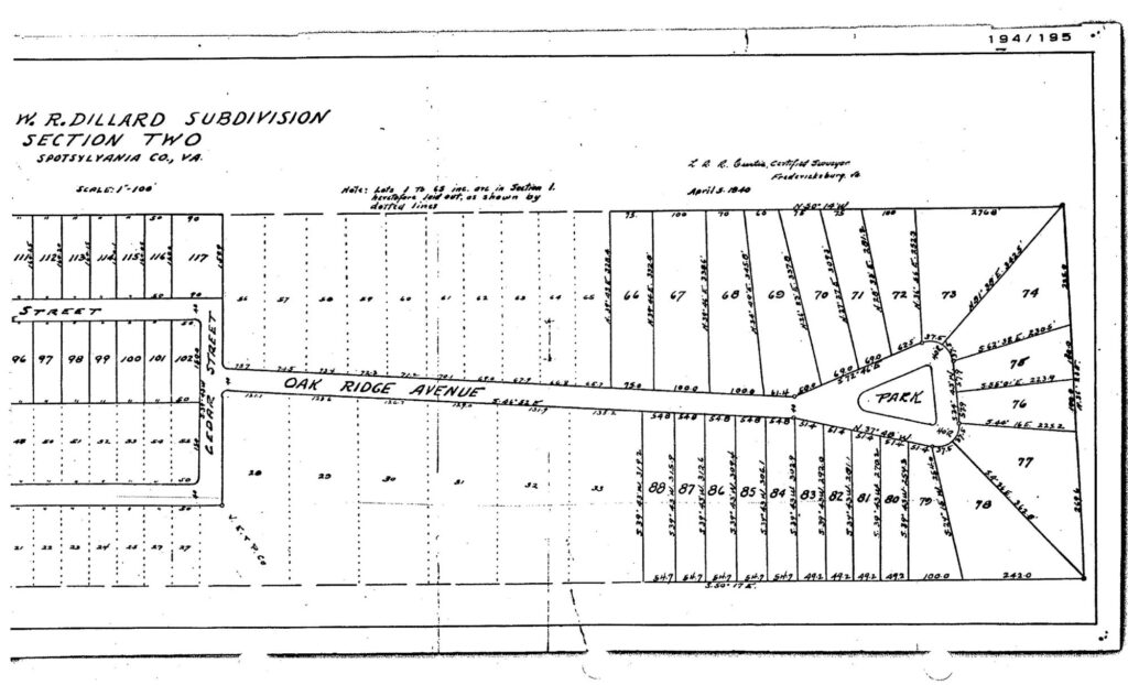
Figure II. Page two of the 1940 Survey of Dillard Subdivision, showing the keyhole court and additional plots.
In 1940, Dillard hired Curtis again to plot an additional 52 lots, which became W. R. Dillard Subdivision Section II and included the recognizable keyhole court at the end of Hillcrest Drive.5 Dillard continued to sell plots in both sections of the subdivision, using the same racial covenant language as the first section. Despite the 1948 Supreme Court decision in Shelley v. Kraemer, which held that restrictive covenants could not be legally enforced, Dillard included racial restrictions until 1950.6 Like many developers who sought to preserve segregated housing after the court’s ruling, he perhaps understood how unlikely it was for a Black homebuyer to challenge discrimination in court, allowing the practice to persist. In 1955, the City of Fredericksburg annexed the Dillard Subdivision as part of its acquisition of a large section of Spotsylvania County adjacent to the city. At this point, racially restrictive covenants were in decline in prevalence due to the Shelley decision, and no properties in the subdivision were sold with such language.
The covenants imposed on the plots indicate the community that Dillard sought to create: one with uniform setbacks, required indoor plumbing, and white-only residents. The restriction against dry toilets suggests connections with Fredericksburg’s sewage system, reflecting Dillard’s aspirations to create a suburban, city-aligned community even before the 1955 annexation. Because the lots were sold without existing buildings, buyers could design their own houses and hire a variety of contractors. As a result, the subdivision developed with a diverse architectural character, primarily composed of smaller, one-and-a-half-story late-Craftsman and ranch-style homes. The white-only residency restriction was a significant aspect of Dillard’s vision. Bordering many black-owned properties, the subdivision established a new racial boundary, dictating where Black residents could live and reinforcing segregated residential patterns. Unlike the rest of the city, however, the subdivision had no geographic or physical buffer between Black-owned properties and white neighborhoods, with racial covenants acting as the sole method to keep minorities out and making the “color line” particularly defined between properties. This model, while not unique to the Dillard Subdivision, added to the narrative of racial boundaries in Fredericksburg.
- “Public Sale of a Highly Desirable Small Farm,” The Free Lance-Star, December 7, 1935. Accessed November 20, 2025, https://books.google.com/books?id=ufJNAAAAIBAJ&printsec=frontcover#v=onepage&q&f=false. ↩︎
- “W.R. Dillard Dies; Longtime Treasurer,” The Free Lance-Star, September 7, 1984, Accessed November 20, 2025, https://books.google.com/books?id=cOJLAAAAIBAJ&printsec=frontcover&source=gbs_ge_summary_r&cad=0#v=onepage&q&f=false; Deed Book 114, Page 200 (1936), Spotsylvania County Courthouse, Spotsylvania Court House, VA. ↩︎
- Deed Book 114, Page 438 (1936), Spotsylvania County Courthouse, Spotsylvania Court House, VA. ↩︎
- Deed Book 114, Page 457 (1936), Spotsylvania County Courthouse, Spotsylvania Court House, VA. ↩︎
- Deed Book 123, Page 195 (1940), Spotsylvania County Courthouse, Spotsylvania Court House, VA. ↩︎
- Deed Book 151, Page 82 (1950), Spotsylvania County Courthouse, Spotsylvania Court House, VA. ↩︎